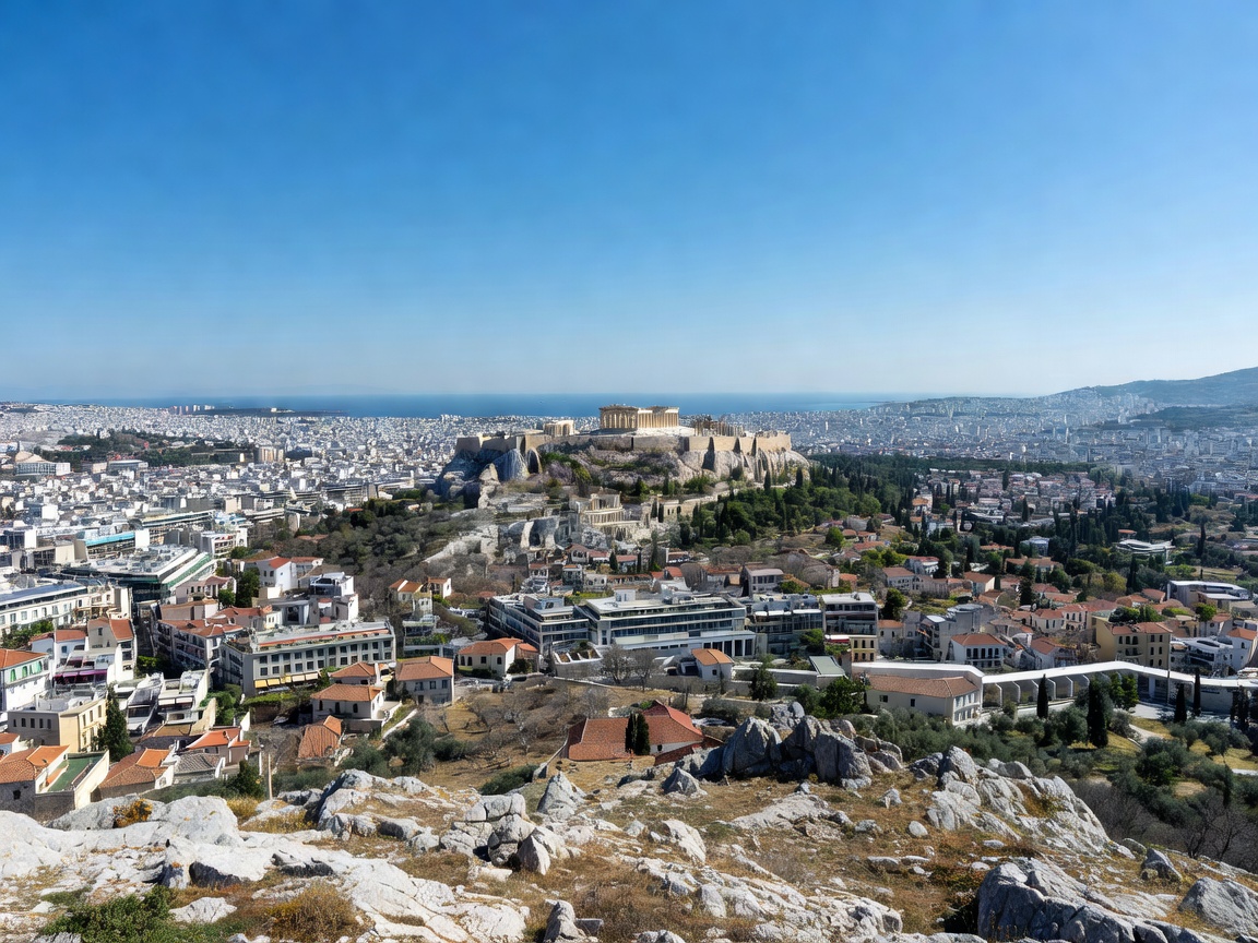
Rising abruptly from the central urban sprawl of the Greek capital, Mount Lycabettus (Lykavittos) represents the highest geographic point in the Athens basin. Standing at 277 meters (908 feet) above sea level, this Cretaceous limestone monolith towers over the surrounding Kolonaki district, providing an unparalleled 360-degree topographic viewpoint across the Attica peninsula.
Geology and Orientation
Unlike the nearby Acropolis rock, which stands at approximately 150 meters, Mount Lycabettus affords an oblique, downward-sloping perspective over the historic monuments of antiquity. The limestone structure is characterized by steep, fractured cliff faces along its southern and southwestern slopes, draped in dense pine reforestation that was executed throughout the early twentieth century to stabilize the rock face against erosion.
From the compact summit terrace, marked by the 19th-century whitewashed Chapel of Saint George (Agios Georgios), viewers can clearly trace the geological boundaries that define Athens: Mount Parnitha to the north, Mount Pentelikon to the northeast, Mount Hymettus to the east, and the expanse of the Saronic Gulf to the southwest, punctuated by the port of Piraeus and the distant hills of Salamis Island.
Sightline to the Parthenon
Looking southwest from the summit platform, the Acropolis plateau sits perfectly framed against the backdrop of the sea. During late afternoon, western cross-lighting accentuates the colonnades of the Parthenon and the Erechtheion, providing optimal depth separation for telephoto lenses between 70mm and 200mm focal lengths.
Comparison of Ascent Modes
Visitors have three distinct transit alternatives to reach the observation terrace, each differing in physical strain and scenery:
| Method | Transit Time | Physical Effort | Visual Scenery En Route |
|---|---|---|---|
| Funicular Railway (Aristippou St) | 3 minutes | Minimal (Enclosed tunnel) | None (Subterranean transit) |
| Paved Switchback Footpath | 20–30 minutes | Moderate cardiovascular | Continuous western perspectives |
| Vehicle Road to Theater Ring | 5–10 minutes | Low (Vehicle access) | Eastern panorama toward Hymettus |
Atmospheric Dynamics & Air Quality
A critical consideration for evaluating clarity from Mount Lycabettus is the Attica thermal inversion. During periods of summer stillness, the urban plain can accumulate vehicle exhaust and dust—historically termed the nefos.
The most crystalline observation conditions occur immediately following northern frontal systems or during late autumn rain showers that strip particulate matter from the air. Under these conditions, the visibility radius can extend past 45 kilometers, revealing the volcanic peaks of Methana and the mountains of the Peloponnese across the Saronic waters.
Summit Infrastructure and Access Advice
- Platform Capacity: The flagstone viewing terrace surrounding the chapel is constrained in surface area. On summer evenings, visitor counts often peak between 19:30 and 21:00, leading to congestion near the viewing wall.
- Wind Exposure: The exposed peak frequently experiences winds 10 to 15 knots higher than street level in Kolonaki. Sturdy tripod anchors are required for nighttime long-exposure photography.
- Night Illumination: After sunset, the municipal floodlighting of the Acropolis, the Ancient Agora, and the Panathenaic Stadium switches on, making Lycabettus the premier platform for studying the archaeological layout of central Athens.