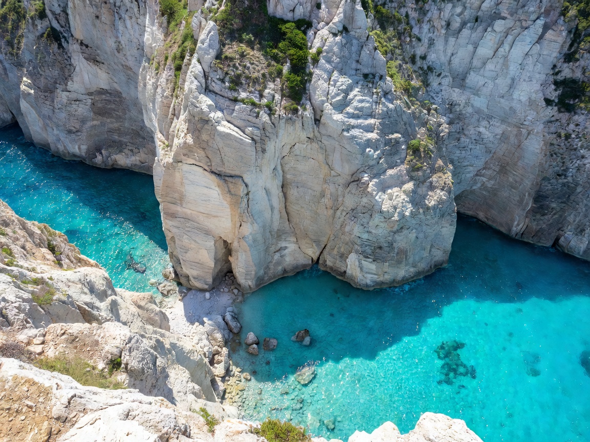
Situated along the rugged northwestern coastline of Zakynthos in the Ionian Sea, the coastal cliffs overlooking Navagio (Shipwreck Cove) represent one of the Mediterranean's most dramatic sheer limestone escarpments. The plateau terminates abruptly in a near-vertical white limestone cliff plunging approximately 200 meters (650 feet) into an enclosed cove of intense turquoise water, in which rests the rusted hull of the freight coaster MV Panagiotis, stranded since October 1980.
Geomorphology and Color Dynamics
The extraordinary saturation of the water below the Navagio cliffs is a direct consequence of local coastal karst geology. The vertical cliff face is composed of pure Upper Cretaceous limestone. As maritime swell and winter storms erode the base of the wall, fine calcium carbonate particles remain suspended in the water column.
When intense overhead sunlight strikes these suspended mineral particles, Rayleigh scattering occurs, diffusing the shorter blue and turquoise wavelengths and giving the water its characteristic luminous neon appearance. The contrast between this electric turquoise sea, the bleached white pebble shore, and the vertical pale rock walls creates an exceptional visual phenomenon.
Optimal Sun Angle for Water Clarity
Unlike western-facing sunset viewpoints where low-angle light is favored, the Navagio canyon requires a high solar elevation to illuminate the deep sea floor. Between 11:00 and 14:00, the sun climbs high enough to eliminate the shadow cast by the southern 200-meter wall, illuminating the entire cove evenly.
Viewing Infrastructure Comparison
Observation options at the cliff edge have undergone substantial municipal modifications to balance public safety against natural erosion:
| Observation Area | Elevation | Structure Type | Safety Status |
|---|---|---|---|
| Official Steel Viewing Cage | ~190m | Cantilevered metal platform | Reinforced handrails, regulated capacity |
| Northern Ridge Flag Path | ~210m | Natural rocky goat track | Unfenced, subject to regional closures |
| Southern Headland Bluff | ~180m | Rough scrub plateau | Extremely hazardous edge; unstable karst |
Seismic Activity and Structural Stability
The Ionian island arc sits along one of the most active tectonic subduction zones in the Mediterranean. As a result, the cliffs of northwestern Zakynthos are subject to ongoing seismic fracturing and rockfall events.
In recent years, episodic tremors and winter rainwater infiltration have led to substantial cliff face detachments. Consequently, civil protection authorities periodically restrict access to the perimeter footpath running along the northern rim beyond the official cantilevered platform. Observers must respect official barrier demarcations and warning signage installed by the local municipal prefecture.
Access Route and Environmental Conditions
- Road Transit: Access to the viewpoint is via inland mountain roads passing through the villages of Volimes or Anafonitria. The road terminates in a paved parking circle adjacent to the monastery of Agios Georgios Krimnon.
- Thermal Exposure: The exposed limestone plateau lacks vegetation higher than low Mediterranean garrigue scrub. Surface rock temperatures in July and August frequently exceed 40°C (104°F), with intense glare reflected from the white limestone bedrock.
- Drone Regulations: Flight restrictions apply along the cliff boundary, and strong updrafts rising up the vertical rock face frequently create severe turbulence for light unmanned aerial vehicles.