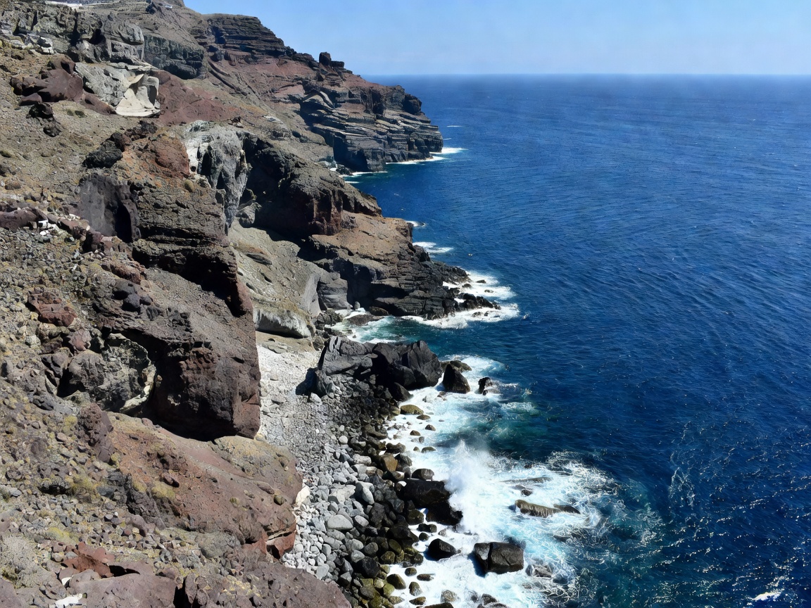
The volcanic caldera rim of Santorini is one of the most recognizable geologic formations on Earth. Formed during the catastrophic Minoan eruption approximately 3,600 years ago, the present-day landmass features a crescent-shaped cliff line rising between 200 and 330 meters vertically above the Aegean Sea. The resulting amphitheater encloses a flooded marine basin measuring approximately 12 kilometers by 7 kilometers, centering on the active volcanic domes of Nea Kameni and Palea Kameni.
Topography of the Rim Walk
The classic walking route linking the provincial capital of Fira to the northern settlement of Oia follows the natural knife-edge crest of this volcanic rim. The path traverses approximately 10.5 kilometers of mixed terrain, ranging from whitewashed urban cobblestones to unpaved cinder paths composed of red pozzolana, black basalt scree, and compacted volcanic ash.
Because the cliffs plunge directly into the sea on the western flank while sloping gently downward to agricultural vineyards on the eastern shore, viewpoints along this ridge present contrasting perspectives. To the west lies an unobstructed, vertically terrifying expanse of sea and caldera rim; to the east, the sun rises over flat plains toward the island of Anafi.
Skaros Rock Promontory
Located just below Imerovigli, the conical basalt promontory of Skaros was once the island’s primary medieval fortress. A footpath descends the cliff steps to the headland and circles toward the isolated Chapel of Panagia Theoskepasti, presenting an unobstructed 270-degree panorama of the central basin without rooftops obscuring the frame.
Viewing Sectors Comparison
Depending on atmospheric moisture and seasonal heat hazes, the aesthetic qualities of the caldera change substantially across different sectors of the trail:
| Sector | Altitude | Surface Quality | Crowd Concentration |
|---|---|---|---|
| Fira to Firostefani | 220m – 260m | Paved stone & masonry | High (pedestrian flow) |
| Imerovigli Crest | 330m (Highest) | Stone steps & asphalt | Moderate |
| Profitis Ilias Church | 310m | Loose pumice gravel | Low to Moderate |
| Mavro Vouno Edge | 180m | Volcanic scree trail | Low |
| Oia Approach | 130m | Flagstone paving | Very High |
Technical Factors for Observation & Photography
Visitors assessing the caldera for panoramic clarity must contend with specific seasonal atmospheric phenomena. During summer months, the prevailing Aegean wind—the Meltemi—regularly blows from the north and northwest. While these gusts keep daytime temperatures manageable, they can create maritime salt hazes across the lower water surface, reducing contrast when looking across toward Thirassia island.
Morning light strikes the westward-facing volcanic strata head-on, revealing the deep rust, ocher, and charcoal strata bands that illustrate thousands of years of layered volcanic events. By contrast, evening hours cast the caldera walls into deep purple shadow, turning the central volcanic isles into crisp silhouettes against the glittering waters.
Access, Terrain Precautions & Regulations
While the municipal walkways within Fira and Oia feature railings and stone retaining walls, the middle section connecting Imerovigli to Finikia crosses open ridges without artificial barriers. Hikers should note:
- Footwear: Lightweight boots or lug-soled trail shoes are essential; fine volcanic ash on inclined rock plates creates significant slip hazards.
- Hydration & Sun: The caldera trail features negligible tree canopy or artificial shade structures between Imerovigli and Oia. High thermal radiation reflects upward from white limestone buildings and dark basalt rock.
- Drone Restrictions: The Hellenic Civil Aviation Authority classifies the entire caldera airspace as restricted, particularly near the Fira emergency helipads and southern flight approaches. Flight permits are mandatory for unmanned aerial systems.